
- Pacific Islands Climate Change Cooperative |
- Maps |
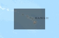
- Hawaii Monthly & Annual Rainfall Maps, 2000-2012
Hawaii Monthly & Annual Rainfall Maps, 2000-2012
Dec 11, 2015
Created by
Abby Frazier

Recommended by Patrick Grady
- Description
- Month-year rainfall maps for the State of Hawai‘i were created from January 1920 to December 2012 as a spin-off project from the Mean Rainfall Atlas of Hawai‘i project (http://rainfall.geography.hawaii.edu/). Raster files can be downloaded from the Rainfall Atlas website.
The monthly & annual maps from 2000-2012 are shown here in inches.
Please use the following citation:
Frazier, A. G., Giambelluca, T. W., Diaz, H. F. and Needham, H. L. (2015), Comparison of geostatistical approaches to spatially interpolate month-year rainfall for the Hawaiian Islands. Int. J. Climatol.. doi: 10.1002/joc.4437"StJan 2000 in" = Statewide January 2000 rainfall in inches; "Ann" = Annual.
- Location
- Credits
- Frazier, A. G., Giambelluca, T. W., Diaz, H. F. and Needham, H. L. (2015), Comparison of geostatistical approaches to spatially interpolate month-year rainfall for the Hawaiian Islands. Int. J. Climatol.. doi: 10.1002/joc.4437
- Use Constraints
 This work is licensed under a Creative Commons Attribution 3.0 License.
This map is visible to everyone
About the Map Author
Abby Frazier
Research Geographer with US Forest Service
I am a Post-Doctoral Research Geographer with the US Forest Service, based in the Department of Geography at UH Manoa in Honolulu, HI. My research interests include climatology, GIS, geostatistics, landscape ecology, climate variability (ENSO & PDO), rainfall and drought in Hawai‘i, and big data...